Directory and moreAll AntiquesFurnitureSilverArtJewellerySalvageClocksMirrorsChairsGlassCeramicsDirectory and moreBedsBookcasesCabinetsChairsChest of DrawersCupboardsDesksDressersDressing TablesSideboardsStoolsTablesWardrobesBasketsBowlsBoxesCandlesticksCard HoldersCoastersCoffee PotsCondimentsCutleryDecanter LabelsDishesSpoonsVasesCityscape ArtContemporary ArtDrawingsEaselsLandscape ArtMarinescape ArtMiniaturesOil PaintingsPastelPortraitsSeascape ArtStill LifeWatercoloursAntique Bracelets & BanglesBroochesCufflinksDiamond RingsEarringsEngagement & Wedding RingsJewellery BoxesLocketsNecklacesPendantsRingsSets - Demi ParureSolitaire RingsBathsChimneysColumnsDoor Handles / Door Stops / Door KnockersDoorsFireplacesFlooringIndustrial antiquesLocks / KeysReclaimed & Industrial LightingReclamationWindowsBracket ClocksCarriage ClocksClock SetsCuckoo ClocksDial ClocksFusee ClocksGrandfather ClocksLongcase ClocksMantel ClocksPocket WatchesSkeleton ClocksWall ClocksWatchesConvex MirrorsDressing MirrorsDressing Table MirrorsFrench MirrorsGilt MirrorsLarge MirrorsOval MirrorsOvermantle MirrorsPier MirrorsSwing MirrorsToilet MirrorsVictorian MirrorsWall MirrorsArmchairsClub ChairsCorner ChairsCountry ChairsDesk ChairsDining ChairsHall ChairsKitchen ChairsLibrary ChairsOffice ChairsPair of ChairsRocking ChairsWing ChairsAntique Drinking GlassesChampagne GlassesDecantersEpergnesGlass BowlsGlass CruetGlass DishesGlass InkwellGlass JugsGlass SculpturesGlass VasesScent BottlesTantalusAnimal FigurinesBlue and WhiteBowlsChargersChinaCoffee Pots & SetsDinner ServiceDishesFigurinesJugsTea Pots and SetsVases (Ceramic)Business DirectoryLoveAntiques DealersHome & LivingBlogMaterialsPeriodsArtisansOriginsGifts For HimGifts For Her

Art & Stuff

I specialise in affordable original artworks - mainly traditional watercolours and oil paintings but I also have a range of contemporary artworks including limited edition lithographic prints. I also stock a limited selection of antiques and collectables, including treen, ceramics and glass. I have now opened a shop at 26 High St Wallingford (OX100BU) between Reading and Oxford, but I also trade online. My website, www.artandstuffgallery.com has a gallery section with several mini-galleries where my items are displayed, including more contemporary items not shown on LoveAntiques.
Address
Art & Stuff
Wallingford
Oxfordshire
United Kingdom
OX10 0BU
Directions
Directly opposite The George Hotel
Opening times
Friday & Saturday 11am to 4.30 pm ish. Sunday 12pm to 4pm
Mobile
+447415 855890
LoveAntiques Dealersince Jul 2016Approved item846 sales by dealerFree DeliveryAvailable for local pick-up
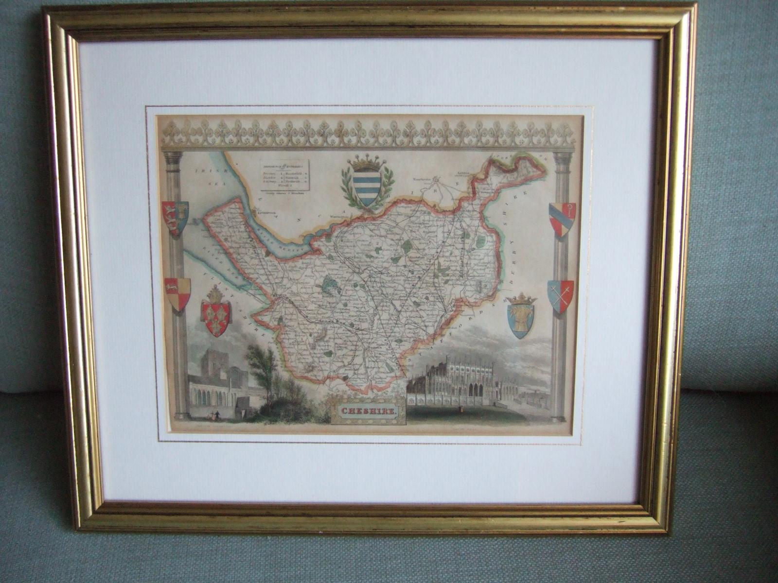
Thomas Moule (1784-1851) Map of Cheshire ca.1837
REF: P2398 / LA479880
£59
€67
$79
Secure Payments By
LoveAntiques Dealersince Jul 2016Approved item846 sales by dealerFree DeliveryAvailable for local pick-up
Description
This is a map of Cheshire from mid 18th century by Thomas Moule.
Thomas Moule (1784-1851) was an antiquarian, a writer on heraldry and an influential map maker. He is best known for his county maps of England published separately between 1830-37 and then together as "English Counties Delineated". These are steel engravings with highly decorated borders and images of important buildings, harking back to earlier styles. They nevertheless kept up with developments such as the railways.
measurements
Height:
20 cm
Width:
26 cm
Overall size 33cm x 39cm
declaration
Art & Stuff has clarified that the Thomas Moule (1784-1851) Map of Cheshire ca.1837 (LA479880) is genuinely of the period declared with the date/period of manufacture being Mid 19th Century
condition
Excellent. Presented in a smart gilt wooden frame and lined cream mount
additional info
Category:
Material:
Artisan:
Date of Manufacture:
Mid 19th Century
location
This Thomas Moule (1784-1851) Map of Cheshire ca.1837 is located in Oxfordshire, United Kingdom
Share:
A selection of items from Art & Stuff
Art & Stuff has 147 items available.£ 130
€148
$175
Art & Stuff
Lalique Glass Pin Dish in Form of a Dove
£ 135
€154
$181
Art & Stuff
Saxton & Hole: Map of Oxfordshire ca.1637
£ 145
€165
$195
£ 48
€55
$64
Art & Stuff
Sunderland Lustre Ware Jug
£ 125
€143
$168
Art & Stuff
Phil Greenwood (b.1943): Etching "Tree Net"
£ 165
€188
$222


